
Walk a Bartlett Street Record
A useful Bartlett street directory search moves from geography to names. First confirm the address as written today. The Village says homes north of Devon Avenue and east of Illinois Route 25 are generally in Cook County, except Bartlett Pointe West in Kane County. Homes south of Devon and east of Route 25 are in DuPage County. A parcel map then confirms the county, township, and property identification number, or PIN.
Keep owners, voters, applicants, and occupants in separate columns. An assessor card may name an owner and tax-mail recipient. A deed records parties to a transfer. A permit can name an applicant or contractor. Those roles do not prove that each person lived there. Save the retrieval date as well. Current assessment cards can change after a transfer or tax update, while a deed stays tied to its recording date. Two valid records can display different names because each answers a different question.
- Enter the full address in the matching county assessor or parcel viewer.
- Save the PIN, legal description, township, and municipality.
- Use the owner name and PIN in the county recorder index.
- Check only voter and municipal records allowed for that purpose.
- For an earlier household, consult a dated phone or criss-cross directory and verify it elsewhere.
Repeat the chain parcel by parcel for a whole road. Preserve the county source and date for every result.
Bartlett Streets Cross Three Counties
The county split is the key local fact in a Bartlett street directory. Cook routes include the Cook County Assessor address search and CookViewer. DuPage parcels use DuPage Property Lookup and its Parcel Viewer. The Kane portion uses county assessment links and KaneMap.
Township labels resolve close calls. The Village names Hanover Township in Cook and Wayne Township in DuPage. Its community profile also identifies St. Charles and Elgin townships for the Kane area. A Bartlett mailing address is a routing hint, not a legal boundary. Confirm the parcel before calling an office or ordering a record. If the county remains unclear, compare the Village county page with the parcel viewer. County identity controls where deeds, assessments, court files, and many election records are kept.
County first. A Bartlett postal label does not select the assessor, recorder, court, or election custodian by itself.
Bartlett Street Search Fields
Each county accepts different inputs. Cook requires the house number and says to enter the street without its suffix. DuPage offers address, billing-name, map, and PIN paths. Kane GIS accepts an address, PIN, or subdivision and can reveal nearby parcels.
| Official system | Address inputs | Alternate | Result |
|---|---|---|---|
| Cook Assessor | Number, direction, unit, street, city, CAPTCHA | 14-digit PIN; neighborhood | Assessment record |
| CookViewer | Address or intersection | 10/14-digit or dashed PIN | Details, nearby search, export |
| DuPage Lookup | Address | PIN, billing name, map | Owner, transfer, assessment tabs |
| KaneMap | Address | PIN, subdivision | PINInfo, aerials, buffer |
If an address fails, remove punctuation, check direction, try the PIN, or search the subdivision. Older records may use Spaulding or another prior label. Street suffixes also cause missed results. Cook asks users to omit the suffix, while another system may expect it in a selected field. Try one change at a time and record which form produced the match.
The Cook address form shows why exact formatting matters.
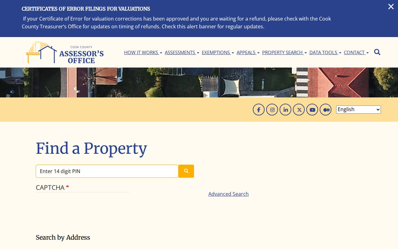
The captured fields separate address, PIN, and neighborhood routes, preventing unlike Bartlett results from being mixed.
Bartlett Records Indexed by Address
No single Bartlett street directory contains every useful record. Choose a source based on whether the question concerns a parcel, transfer, project, or dated household clue.
| Record | Keeper | What it shows | Access |
|---|---|---|---|
| Assessment card | County property office | Owner, mailing data, class, transfers | Web portal; office |
| Parcel map | County GIS | PIN, lot, nearby parcels, districts | Map and export tools |
| Recorded instrument | County recorder | Grantor, grantee, deed, lien, plat | Index; in-office research |
| Permit file | Village or county | Work, applicant, site, status | Portal, phone, counter, FOIA |
| Historic phone book | Regional library | Dated subscriber, address, number | Catalog and physical volume |
The DuPage Property Lookup illustrates the parcel-card approach.
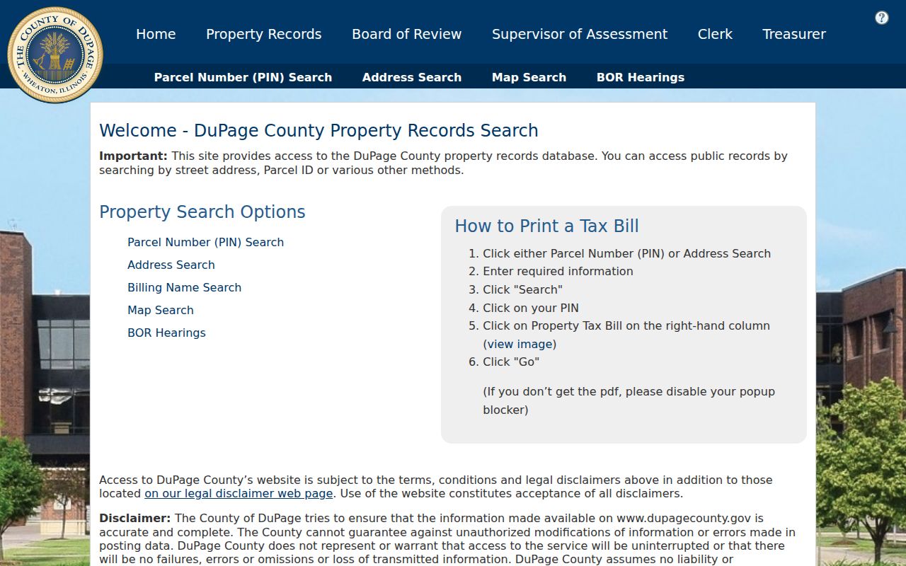
Its tabs distinguish tax, owner, transfer, exemption, assessment, and map data, so each name can be labeled by role.
Map Bartlett Streets by Parcel
GIS means geographic information system. County maps place a parcel record on the ground. CookViewer can search intersections, show nearby parcels, compare them, print, and export data. Its inspected archive layers run from 2000 through the current release. DuPage supports parcel, address, subdivision, intersection, selection, and buffer tools. KaneMap adds PINInfo, aerial years, tax maps, buffers, and KML export.
A map is not a survey or title opinion. Use it to identify the lot, then open the assessor or recorder source. Kane's workflow begins with a parcel or address, opens PINInfo, sets a distance, and can produce mailing addresses for parcels in the buffer. Aerial layers can show when a structure or road existed, but the image cannot identify people. Pair map evidence with a dated card, permit, plat, or instrument.
- Parcel
- A mapped unit of land with a county identifier.
- PIN
- The number connecting map, tax, and deed systems.
- Situs address
- The physical site, which may differ from the tax mailing address.
- Plat
- A recorded drawing of lots, streets, easements, or a subdivision.
- Criss-cross directory
- A dated volume arranged by street or phone number.
Follow Bartlett Deeds by Street
Once the PIN is known, the recorder supplies the ownership chain. DuPage's index includes documents and images from March 16, 1961. It accepts a person, bank, trust, subdivision, street, PIN, document number, type, and date range. Start with a deed group and narrow dates. Kane says its property records reach 1837 and offers free online and office research. Cook connects recording records with its property system.
A grantor transfers an interest; a grantee receives it. Neither proves residence. Save the document number, date, legal description, and parties. For gaps, ask whether an office terminal holds broader history. Cook recording is at 118 N Clark Street, Chicago; DuPage is at 421 N County Farm Road, Wheaton; Kane is at 719 S Batavia Avenue, Geneva.
For the old physical volumes, use the Bartlett city directory collections.
Bartlett Permits Leave Address Clues
The Bartlett Building Division requires permits for listed construction, repair, alteration, replacement, movement, and some changes of use. Applications may include work, use, cost, a contract, survey, or legal description. An applicant or contractor is not automatically a resident.
No fully inspected open Bartlett permit index was found. Use the city page, call Planning and Development Services at 630-540-5920, visit Village Hall, or file a narrow request through Bartlett FOIA. Give an address, type, and dates.
The DuPage Accela lookup offers address, parcel, owner, and record paths.
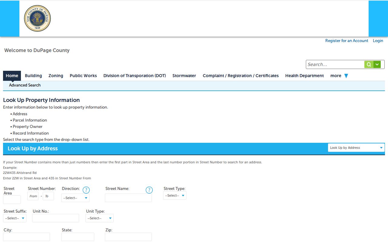
The capture also shows that anonymous access can be narrower than account access.
Kane Bartlett Address Exception
Bartlett Pointe West is the named exception in the Village's county rule. Check a Kane result in the property locator, KaneMap, and township assessor source. The Kane property locator requires an address and a suggested match.
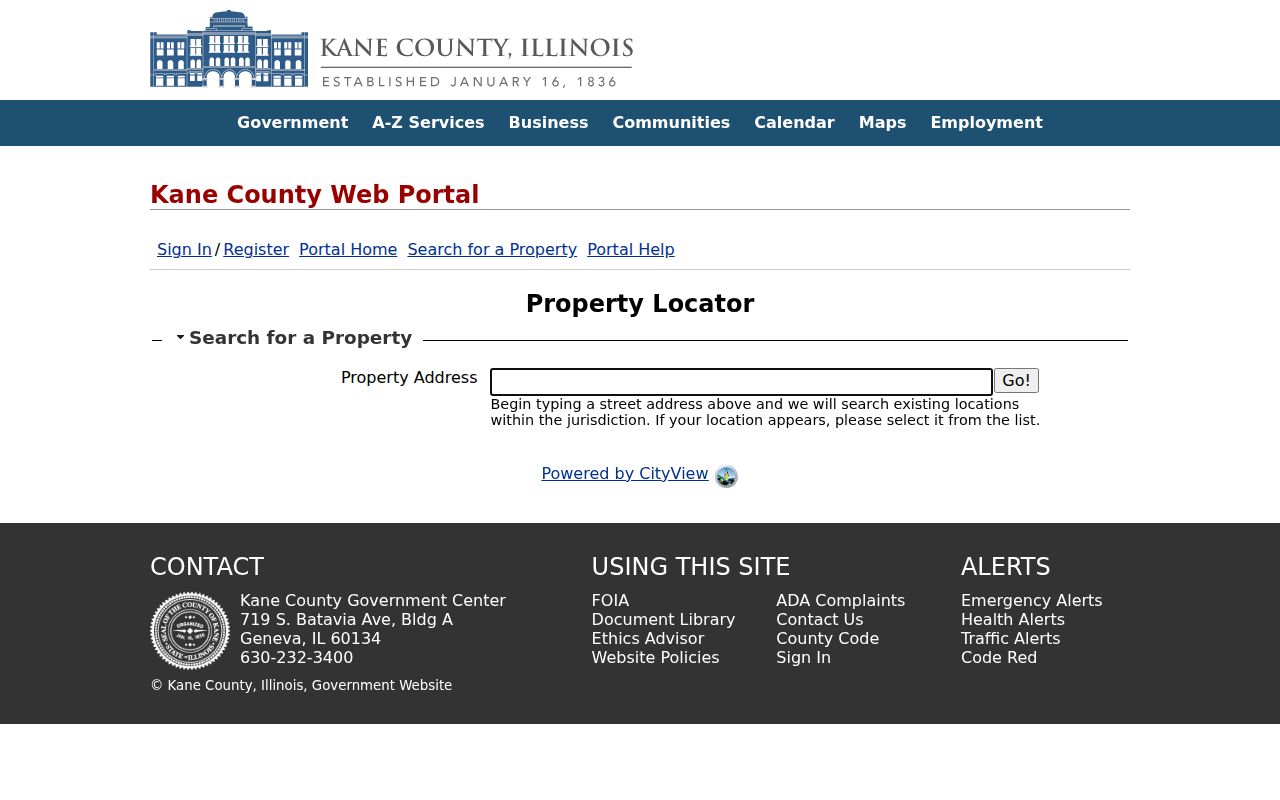
That step reduces false matches and keeps a Kane parcel from being forced into a DuPage path merely because Bartlett appears in the mailing line.
Old Bartlett Streets Need Context
The 1873 depot and Spaulding area explain why old address evidence may not match today's maps. The Depot Museum records a failed Spaulding incorporation effort in 1959, then annexation into Bartlett and Elgin. Old directories may classify places through Roselle, a phone exchange, railroad stop, or postal label.
Search both current street and historic term. Compare the directory with a newspaper, plat, and deed. A result that vanishes may reflect a label change, not a move.
Note: Historical labels aid a search but do not establish a current Bartlett address.
When Bartlett Phones Rivaled People
Village history reports 408 people and 200 telephones in 1910. This makes phone sources unusually useful, while still incomplete. A line could be unlisted, shared, business-based, or filed under a nearby exchange.
Regional holdings include Bartlett/Roselle and Bartlett/Roselle/Bloomingdale books. Treat each entry as dated evidence and verify it with a parcel, deed, census-era source, newspaper, or cemetery record.
Bartlett Street Directory Limits
A property portal names an owner, taxpayer, or mailing recipient, not every occupant. A voter tool has its own rules and date. Permits name project parties. Utility data, protected voter fields, safety-program records, and motor-vehicle addresses are not open household lists.
State the source, date, and role with every name. Use the counter, phone, mail, library, archive, or a narrow Illinois Freedom of Information Act request when the web record is unclear.
Public access also varies by channel. Web portals are the fastest start, but they are not the full archive. Cook, DuPage, and Kane maintain office service, phone contacts, and recording research. Bartlett Village Hall handles municipal permits and narrow FOIA requests. Libraries and museums supply phone books, newspapers, atlases, and old labels missing from county web forms. Mail and staff requests remain options when a trip is not practical.
Lawful use. Bartlett address records support lawful personal and civic research. Never use them to stalk, harass, threaten, or expose a protected person.