
Bartlett Neighbor Record Sources
Different official sources answer different questions about a Bartlett block. A GIS map defines nearby parcels. The assessor or tax card describes a parcel and may name an owner or mailing recipient. A plat explains lot layout and shared legal history. None is a full list of occupants, and no official Bartlett neighborhood-association directory was located in the reviewed sources.
| Source | What It Shows About a Block | Access |
|---|---|---|
| CookViewer | Nearby parcels, zoning, districts, imagery, and building traits | Online nearby search and map selection |
| DuPage Parcel Viewer | Selected parcels, subdivisions, roads, parks, and buffer areas | Online PIN, address, subdivision, shape, and buffer tools |
| Kane GIS / KaneMap | PINInfo, parcels, aerial layers, and a chosen-distance buffer | Online address, PIN, subdivision, and map selection |
| Recorder plats | Lot lines, subdivision identity, and common legal history | County portal or public terminal |
| Local archives | Historic block labels, roads, households, and civic places | Libraries, museums, newspapers, atlases, and directories |
Choose the source by the question. Use a buffer for parcels within a stated distance, a plat for one subdivision, and road records for maintenance responsibility. If the aim is a current occupant, parcel ownership is only a lead. A renter or family member may never appear on the property roll.
Bartlett Neighbors Cross County Lines
Bartlett spans Cook, DuPage, and Kane Counties. The Village counties page says homes north of Devon Avenue and east of Illinois Route 25 are generally in Cook, except Bartlett Pointe West in Kane. Homes south of Devon and east of Route 25 are in DuPage. Treat that rule as orientation and confirm each parcel on an official map.
Two nearby lots can therefore point to different assessors, recorders, tax portals, courts, or election offices. Put the county beside every parcel in a block worksheet. Township can matter too. Official Bartlett sources identify Hanover and Wayne, plus St. Charles and Elgin townships for the Kane portion.
This three-county fact is more useful than an invented neighborhood label. It explains why one address appears in a Cook tool while another close by appears in DuPage or Kane records. When an online search fails, ask the county GIS or recorder counter to resolve the PIN and legal description.
Note: A Bartlett postal address does not prove that one county or one public office holds every record for the block.
Map a Bartlett Neighbor Block
Start from one verified parcel, then move outward by geometry rather than guessed street numbers. A parcel is a mapped unit of land with its own PIN. A buffer is an area drawn a set distance around a point or shape. Both methods define which lots count as nearby before any names are reviewed.
- Normalize the street number, direction, street name, unit, city, and ZIP, then locate it in the correct county map.
- Confirm the starting PIN, municipality, subdivision, and legal description on the parcel detail.
- Select touching parcels or draw a modest buffer that matches the stated block question.
- Record nearby PINs, county, parcel role, and the date of the map. Avoid copying personal contact details.
- Cross-check any needed parcel in the assessor portal, then use recorder plats for lot history.
The output should be a geographic record, not a scraped list. For a whole named street and its address chain, use the Bartlett street directory. The neighbor method stays focused on the immediate block, shared boundary, or defined radius.
CookViewer Finds Bartlett Neighbors
CookViewer accepts an address, street intersection, or a 10-digit, 14-digit, or dashed PIN. After finding the parcel, inspect zoning, district, assessment, and imagery layers. Nearby Search can use a radius or map selection. Export only the geographic fields needed for the stated question.
The captured CookViewer screen shows the nearby-parcel route available for Cook-side Bartlett neighbors.
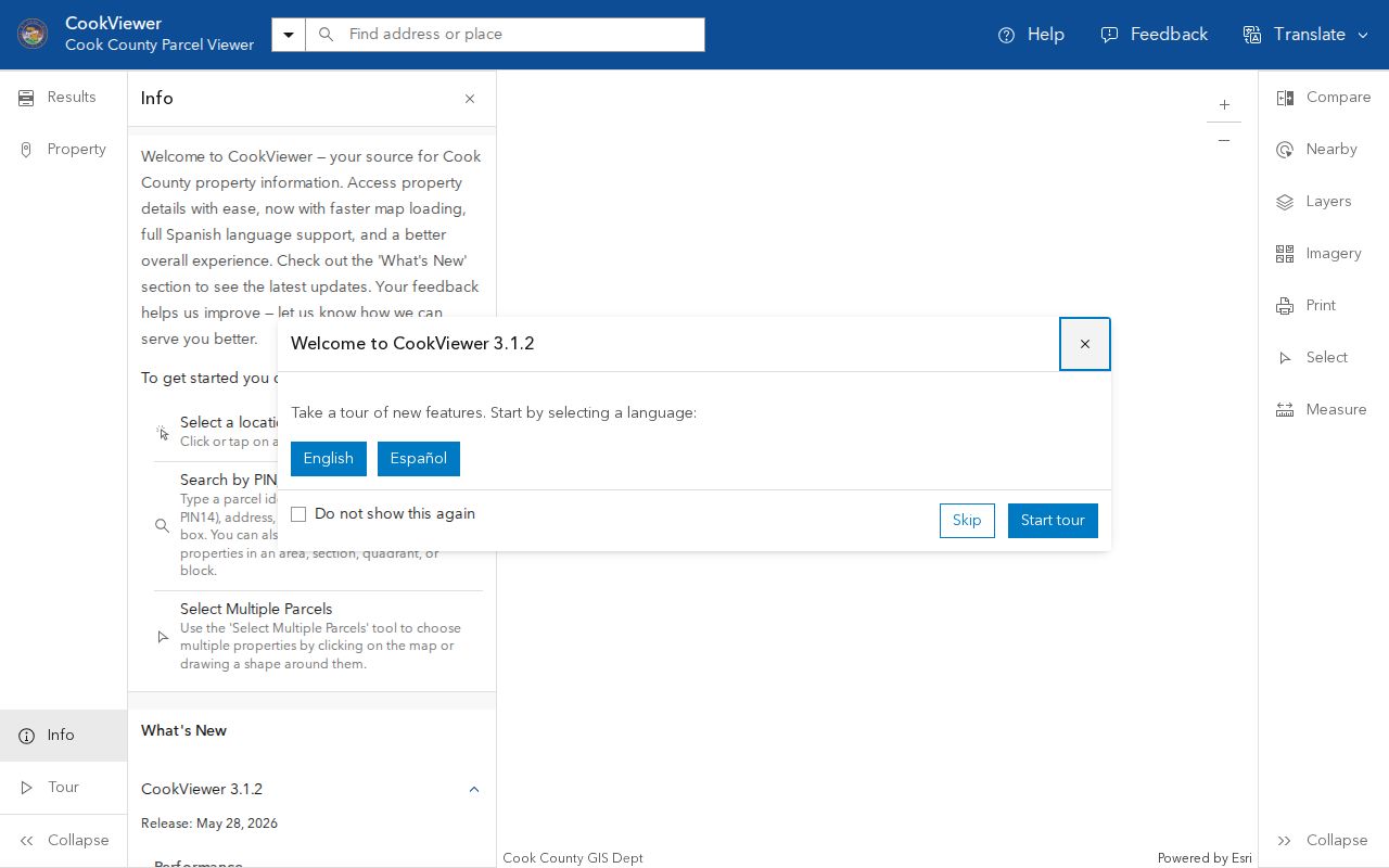
Parcel detail may link to Clerk property records, taxes, assessment data, building traits, districts, and historical imagery. Archive layers cover 2000 to current. Older ownership belongs in recorder records, not in an assumption based on the map archive.
CookViewer can also compare a parcel with a park, road, zoning edge, or public district. Its owner or mailing fields still do not establish who currently occupies the site.
DuPage Maps Bartlett Neighbors
The DuPage Parcel Viewer supports PIN, address, subdivision, street-intersection, map-selection, shape, and buffer work. Pictometry and measure tools add visual context. Save the resulting PINs, then confirm each needed parcel in DuPage Property Lookup before stating a land fact.
For a shared subdivision, follow the subdivision name and legal description to the recorder plat. The plat can show lot layout and common legal history. A screenshot alone is not a survey or title opinion. Village planning files may add dated zoning, permit, or development context.
Anonymous DuPage permit access can be limited. If the online route is incomplete, contact the Bartlett planning counter or make a narrow Illinois Freedom of Information Act request for a map, plat, dated permit, or address-specific planning record. In-person county GIS and recorder terminals remain useful fallbacks.
Kane GIS Maps Bartlett Neighbors
Kane GIS and KaneMap search by address, PIN, or subdivision. Open PINInfo, choose a buffer distance in feet, and inspect the parcels inside it. A mail tool exists for defined public mapping or notice work, but it should not be used to harvest and republish names or addresses.
The captured Kane map shows the parcel buffer that makes a nearby-area question precise.
KaneMap includes aerial years from 2014 through 2025 and lists earlier layers. Those views can show physical change over time. The county warns that GIS is not a survey and is intended for local-government purposes, so resolve a disputed line with official plats and the proper office.
The Kane side also includes the Bartlett Pointe West exception and historic Spaulding geography. Use the map, subdivision, or old label to choose sources, not to claim a current occupant.
Bartlett Neighbor Civic Layers
The Bartlett municipal map portal adds civic features that parcel ownership cannot explain. Parks, schools, the railroad, cemetery, public facilities, county lines, and township lines create practical ways to describe a block without naming people.
The municipal map capture makes those local reference points visible.
Route 20 and Lake Street, Illinois Route 59, Army Trail Road, I-390, the Metra line, and the cemetery are stronger official anchors than unsupported neighborhood names. They also guide requests for road work, planning files, commuter facilities, and public meeting records.
Bartlett Neighbor Streets Have Keepers
The Village street-maintenance page distinguishes Bartlett roads and rights-of-way from state, county, and township routes. That directs a request for snow work, construction, maintenance, or a dated road file to the office that actually holds it.
Road jurisdiction can define a practical neighbor group. Homes along the same physical corridor may receive records or services from different agencies. Note the street segment, nearest intersection, responsible agency, and date. County GIS and Village maps should be compared when jurisdiction is unclear.
For older context, libraries and museums hold atlases, directories, newspapers, depot material, and Centennial booklets. They can explain how a road, rail line, subdivision, or civic label changed. Historic neighbors should be described from dated evidence, not projected onto the current block.
Bartlett Community Directory Limits
No official Bartlett neighborhood-association directory or complete neighborhood-name map was found in the inspected sources. Do not fill that gap with commercial labels. Use recorded subdivisions, county and township boundaries, parks, schools, streets, and official GIS layers. These categories can support a clear records request.
| Route | Best Use | Key Limit |
|---|---|---|
| Official parcel and plat records | Define lots, owner roles, and shared legal geography | Owner is not the same as occupant |
| Library and museum sources | Research historic blocks, roads, groups, and household clues | Coverage varies by year and collection |
| Commercial neighbor tools | Possible preliminary lead | May be stale, merged, or unsupported |
Bartlett Public Library and Schaumburg Township District Library can help with directories, atlases, newspapers, and local databases. Bartlett History and Depot Museums can add railroad, Spaulding, Route 20, and settlement context. Ask for one place and period rather than a list of all nearby people.
Privacy for Bartlett Neighbor Lookups
Parcel records often show an owner or mailing recipient, but they do not list every renter, family member, visitor, or other occupant. Utility and delivery data are not a public resident directory. Illinois confidentiality rules, including the Address Confidentiality Program, can also shield location information for protected people.
Voter services should be used through their stated official purpose and access rules. A public lookup does not authorize a block-wide collection of names. Municipal Frontline and pet-management records are safety programs, not public directories. Never treat absence from a public source as proof that no one lives at an address.
Lawful use. Research Bartlett neighbors for a defined civic, property, historical, or personal purpose. Do not use maps or records to watch, intimidate, harass, or harm anyone.
A sound block record ends with role labels and source dates. State whether a name is an owner, taxpayer, permit applicant, historic directory subscriber, or confirmed occupant. If the record only establishes parcel geography, say exactly that.